Sunday, August 12, 2012

Thoughts on Marriage Equality

In the upcoming November election, Washington will have an opportunity to make history by becoming the one of the first states (Maryland, Maine and Minnesota have the issue on the ballot Nov 6) to embrace marriage equality for same sex couples by a vote of the people—not by the result of a court judgment or a simple act of the state legislature.  Washington voters are being asked to accept the marriage equality law enacted earlier this year.  In doing so, we can demonstrate to the rest of the country and to the world that we are a state that embraces diversity; that we will not be swayed by stereotypes and fear mongers; and that we are truly committed to equal rights for all citizens.
Those who seek to reject the law argue that they want to stand by traditional family values and protect children. What message are they sending to the children they seek to protect?  If you value children, why would you send the message that unless a family fits the ‘traditional’ married; two-parent; stay-at-home mom; go to church on Sunday model it is inferior?  This is offensive not only to homosexual couples (and parents) but to all families who don’t fit the Ozzie and Harriet/Ward and June Cleaver family structure. A child who is loved and supported will grow into a productive and well-adjusted adult regardless of family circumstances. 
Another offensive aspect of this debate is the argument that prohibiting homosexuals to marry is necessary to protect ‘traditional’ moral values. Implicit in this argument is an assertion that homosexuals are inherently immoral.  That we are at best suspect and at worst evil.   A person should not be stereotyped by sexual orientation any more than by religion, race, ethnicity or gender.  A person should be judged by their actions and character alone. 
The social-conservative right uses the stereotype of gays and lesbians as sexually promiscuous, hedonistic and self-centered as a justification for their arguments against homosexual marriage.  That extending civil marriage recognition to homosexual relationships diminishes marriage and threatens the very core of our society.  What gay and lesbian persons seek by gaining marriage equality is to join in society as traditional family units.  When we buck the stereotype by entering into committed relationships we are not weakening society, endangering children or undermining traditional values.  Allowing homosexual couples to make (hopefully) life-long commitments to one another strengthens society and confirms the importance of the institution of marriage. Those who believe in the importance of marriage should be happy that homosexuals want to make such a commitment to one another.
It is also not a culture war on Christianity or any other religion as many believe.  
Even within Christianity there is disagreement on this issue ranging from strong condemnation of homosexuality and same sex marriage; to ‘don’t ask don’t tell’ tolerance; to allowing homosexuals to minister and to marry.  Regardless, nothing about allowing civil marriage rights to homosexuals takes away the right of any religion or denomination to follow its own teachings and values.  The state cannot make a church minister perform a same sex marriage any more than it can force him or her to perform a heterosexual marriage between individuals who don’t meet the faith’s marriage requirements (for example, remarriage after divorce). That is, for the state to recognize a civil marriage between homosexual persons is no more of a threat to religion and society than state recognition of a marriage of previously divorced individual(s).  Thomas Jefferson, a founding father who advocated for a strict separation of religion and government, might well argue: “But it does me no injury for my gay neighbors to marry. It neither picks my pocket nor breaks my leg. “
Gay and lesbian couples contribute to our society every bit as much as heterosexual couples.  We love our partners and children as much as they do.  Why should we not be granted the same recognition and have the same opportunity to make a commitment to our partners?  Why should we continue to sit at the back of the bus and be stereotyped as immoral and promiscuous?  Extending this important legal recognition to us does not threaten heterosexual couples; it does nothing to weaken social institutions; and it does not force anything upon religious faith.  Instead of diminishing the institution of marriage, confirming marriage equality underscores its importance and will strengthen and enrich society.
Believing with you that religion is a matter which lies solely between man and his God, that he owes account to none other for his faith or his worship, that the legislative powers of government reach actions only, and not opinions, I contemplate with sovereign reverence that act of the whole American people which declared that their legislature should 'make no law respecting an establishment of religion, or prohibiting the free exercise thereof,' thus building a wall of separation between church and State.
-Thomas Jefferson, letter to Danbury Baptist Association, CT., Jan. 1, 1802

Monday, April 4, 2011

Desert River 300

Another Windy Adventure
I decided to go over to eastern Washington for the Desert Rivers 300K in hopes of riding in sunshine and maybe even warmth.  A few days before the ride, the weather forecast was not encouraging.  There was a 60% chance of rain and high, gusty winds predicted for the day of the ride.  Nonetheless, after offering to drive a carpool with Steve Davis and Noel Howes, I was committed and had to go.  It seemed my record of bad luck on out of town rides was not to be broken.
Vincent and Kole at the start
Despite the dismal weather forecast, thirteen intrepid riders rolled out at 6:00 with the goal of being back by 2:00 in the morning on Sunday.  The peloton followed the Columbia River Trail road out of Richland in a slight drizzle.

We soon passed into Kennewick and crossed the river to Pasco quickly making the first control at the edge of Burbank.  Like the other riders, I knew we would be pushing a headwind after Waitsburg so my goal was to build up as large a time cushion as possible during the first 100K.  After leaving the control, there were a couple of riders ahead of me, but the gap didn’t seem to be growing so I decided to try and bridge up to them, but found that I could not sustain the effort on uphill grades. Riding alone, I settled into a steady pace.
Riders at Burbank Control
Highway 124 runs parallel to the Touchet River which was running high and a bit muddy due to the recent rain had stopped and the sky was clearing.  I passed the riders I had been unable to catch earlier while one of the group was fixing a flat.  As expected, the group passed me back as we entered the town of Prescott.

After a brief detour off of the main highway, we arrived at the Waitsburg Grocery control.  I stocked up on some supplies for later in the ride and began to prepare mentally for a long stretch into a headwind.  After the short break at the control, I teamed up with Noel and Steve in anticipation of the challenge ahead.
Main Street - Waitsburg
Leaving the main highway, we began a long climb up Middle Waitsburg Road into a headwind.  It was slow going and the need to draft while climbing was very strange.  After the initial climb, there were a few more rollers but we continued to make steady progress.  At the crest of one hill, there were some little kids excited to see cyclists passing their yard.  Noel and I rang our bells and waved as we passed.
Pioneer Park
We finally made it to Walla Walla where Paul and Susan met us at the park control with a selection of traditional rando food.  The Pioneer Park is very pretty, but we couldn’t afford to linger.  After taking a brief rest, it was time to keep rolling.  We proceeded through town and south toward the Oregon border.  This stretch was the most unpleasant part of the ride.  There was a lot of traffic and the shoulder was riddled with assorted debris.

As we entered the town of Morton-Freewater, Noel voiced what I had been thinking—it would be great to stop for some real food.  The first place we saw was the Wee Bit O’Heather cafe.  We all had pie and coffee, which really hit the spot.   Refreshed, we continued on toward Pendleton.

After Milton-Freewater, the road became better and the traffic was not as heavy. However, the headwinds became stronger. We struggled to hold a line, and it seemed that there was little difference between being first or last in our three person pace line.  I lost contact with Noel and Steve on the last climb before Pendleton.  I caught up with them at Hal’s Hamburgers, a drive-in style burger joint, on the edge of town.  We used it as our control stop and enjoyed a meal of burgers and fries.

Leaving Pendleton into a gusting headwind (reportedly gusts up to 46mph); we entered the Umatilla River canyon.  Had it not been for the headwinds, it would have been the highlight of the ride.  We got a slight respite from the wind on some of the shielded corners only to be blasted by the wind as we rounded the bend.  About halfway through the canyon, I felt I was starting to bonk so I requested a quick refueling stop.  Unfortunately, I was unable to keep it down but I felt better afterward and we continued on riding into a beautiful sunset.

Steve needed to fill his bottles, so we stopped at a store at the I-84 intersection to rest and refuel before continuing on to Hermiston and then the Umatilla control.

Excited about the descent into Hermiston, I somehow managed to out run Noel and Steve on the downhill.  After making it into town, I waited for them.  When their lights were in sight, I started up again expecting them to catch up shortly.  Unfortunately, the GPS route and the cue sheet were out of sync.  Following my GPS, I missed the turn which Noel and Steve who were going strictly by the cue sheet made.  Realizing my mistake, I turned back and found the route again.  I made it to the Umatilla control only a few minutes after them.

We all had coffee and a little bit of food in Umatilla.  I was beginning to be toasted and managed to spill some of my coffee while searching for some salty snacks.  I tipped the clerk for the trouble of having to clean it up.  We left Umatilla with 28 miles to go and four hours in which to do it.  After carrying our bikes through the glass riddled tunnel under the interstate, we continued uphill on Plymouth Road.  I focused on trying to keep my speed above the 7 mph needed to finish within the time limit.  With two hours left on the clock, I happily noted we were keeping the pace with about 13 miles to go. 

With about three miles left until the turn on to Clodfelter Road, Noel encouraged us to push for the top and took off expecting us to follow.  Unfortunately, I was beginning to bonk.  Steve encouraged me to stop and take some food.  After the short break, we continued up the hill.  I kept thinking that I’d soon be at the point where we would descend back to Richland.  I was looking forward to cresting a climb and seeing the city lights below.

When I finally made the crest with the lights of the Tri Cities shimmering in the distance, I was relieved to know I’d make it within the time limit.  I let the bike run on the downhill, scrubbing off speed only on sharp corners.  After spending the day struggling on the climbs while fighting the wind, it was nice to get up some speed.  I soon caught up with Steve (I’ve been told that good hubs and a large ass are assets on descents). 

Despite the clear instructions on the cue sheet (this time ignoring my GPS), I missed the turn onto Leslie Road, but caught the mistake before we’d gone very far down the hill beyond it.  After turning around and getting back on course, Steve and I rolled up to the finish at 1:14 completing the ride in 19:14.  Noel had arrived about at 1:00 just 14 minutes before us.  We quickly got our cards validated and rode back to the motel for hot showers and well earned sleep.

I am very grateful to Noel and Steve for sticking with me through the brevet.  Although I don’t mind riding alone, the conditions would have made this ride very daunting.  Thanks to Paul and Susan for planning an excellent course and for the extra food in Walla Walla—it was a great ride.

Wednesday, March 2, 2011

Randonneuring is a Stupid Sport

My Arivaca 400K Experience
Many of my friends—even fellow cyclists—consider attempting to ride 400K in 27 hours to be an act of stupidity even under ideal conditions. In randonneuring, it seems ideal conditions are the exception—not the rule. The AZ Brevet Series Arivaca 400K was true to form.

All smiles at breakfast.

The week before my friend and riding companion, Rick, and I left Seattle for Phoenix the weather was beautiful with highs going into the 80’s. I began to have dreams of riding in February under sunny blue skies. During the last few days before the ride, I watched the ride day forecast for Casa Grande and Tucson with declining optimism. The sunny warm days had been replaced by forecasts of high winds and rain.
Pre-ride breakfast!
Despite the dismal forecast, Rick and I rolled up to the start around 4:30 and collected our brevet cards. I was happy to see Irene Takahashi from Colorado with whom I had finished the Cascade 1200 and another Rick from Seattle—Rick Blacker. During the pre-ride briefing, we were warned about the weather forecast for high gusty winds and overnight rain. The forecast had winnowed the field by seven riders before we even started. We were advised to try to get to Arivaca as quickly as possible. A strong tailwind was promised for the return. 
We rolled out promptly at 5:00 and since there was already a headwind, a pace line formed that rolled along at about 16-17 mph. 

Things were going reasonably well until mile 20. After completing my pull, I discovered Rick was no longer with the group. Looking back down the long straight road behind me, he was no where in sight. I turned around and began to look for him. After about a mile, I found him with another group of riders. The wind and dry air and had caused him to lose a contact lens. After a few more miles, the same contact popped out again. He was unable to get it back in so I suggested he put it in the case and let it soak for a while. We stopped at the Picacho Peak Shell where, using the building as a wind block, he was finally able to get it to stay put.

At this point, we were on our own but there were other riders in sight ahead. We took turns pulling and eventually caught up to Irene who was struggling against the headwind alone. We encouraged her to join us and she gratefully accepted. We would ride the rest of the day together.

Rick & Irene - Marana
Even with the problems, we made it to the Marana checkpoint (44 miles) in pretty good time and left with about 1:20 in the bank. As the three of us rolled south toward Tucson, the wind began to become a significant factor. We made the gradual climb through Saguaro National Park stopping briefly for a photo op and continued through Tucson Mountain Park managing to finish the first 100K in just over five hours—pretty good considering the conditions.

Saguaro National Park
Rolling througn Tucson Mtn Park
For the checkpoint In Tucson, we had to decide between a quick convenience store stop and a bit longer stop at McDonalds for something more like real food. Burgers and salty fries had helped Irene and me through the last 150K of the Cascade 1200 so we agreed that a stop at McDonalds was probably wise. Even without tarrying, we rolled out of the checkpoint with the same 1:20 we’d had at Marana. It was going to be a long day.


As we rolled south on Mission Road, we were fighting a strong, gusty headwind and an uphill grade. We had to work very hard to keep a pace close to the 9-10mph needed just to stay even with the clock. The wind was so strong that if one stopped pedaling to coast, the bike immediately lost momentum. As we slogged along, I thought to myself how stupid randonneuring is. 

At the end of Mission Road, we turned east and soon had a nice long descent into Green Valley. After the long push against the headwind we were glad for a chance to rest our weary legs. We would soon be at the fourth checkpoint where we would refuel for the 30 mile push to Arivaca. As we rested there, we could see a flag snapping in the strong wind—a visual reminder of what we’d been fighting all day and would continue to struggle against for the next 30 miles.

Rick & Irene - Green Valley
We made it to the Arivaca control at about 6:20 (1:19 to spare). Having ridden as hard as we could from Marana, we had not even broken even on minimum brevet pace. This was a manned control and we found a variety of food to keep us going. We ate; changed our batteries; changed into warmer clothes and put on our night gear.We were over half done, but still had a long way to go. Fortunately, the tailwind seemed to be holding. 

Just after we rolled out of the control I had a panic attack that my rain pants were in the drop bag. I apologized to Rick and Irene for the unexpected delay and returned to the checkpoint. I was wrong—my pants were in my front bag all the time. While Rick and Irene waited, a driver stopped and asked if they were all right and warned them to be careful—the road ahead was a favorite of drug runners and human traffickers. As he said, “things happen on that road.” We took heed, but having no choice pressed ahead. 

Arivaca-Sasabe Road is a series of short rollers and numerous potholes which are a challenge to avoid in the dark. The wind was crossing, but slightly in our favor so we made the 12 miles from the control to the intersection with AZ-286 in pretty good time. The sky was clear, the tailwind was holding and we knew there were only a few short climbs remaining in the ride. We proceeded with a sense of optimism cruising along at 21-24mph without effort. However, I noticed Rick was not quite keeping up with us. With 10 miles left until Robles Junction where we hoped to resupply, I encouraged him to take an energy gel to tide him over until we got there. 

We arrived at Robles Junction to find the stores closed, but fortunately Mike had stopped there to ensure all the riders were accounted for to that point. Rick decided he could not continue and was lucky that Mike had room for him and his bike. I was disappointed for him, but was grateful to be spared the potential of making the painful choice between a personal DNF and leaving him should he get in trouble later in the ride. I thanked him for this later when we were both back at the hotel. Irene and I continued on with the hope there would be a store open in Picture Rocks. 

With the tailwind, the last climb through Saguaro National Park didn’t seem very hard. When we arrived at Picture Rocks there was a store open so we stopped. Against the stereotype, I often find stores manned with charming and interesting people; and when one walks into store wearing biking attire late at night, it usually generates questions. Tonight was no exception and we chatted about the ride with the clerk while we warmed up and consumed our purchases.  

Having made the stop at Picture Rocks, we decided we could get by with just a coffee to document our passage through the Marana checkpoint. We were preparing to leave just as the group of young riders who had been behind us all day rolled up. 

Although it was getting colder, the tailwind was holding. Irene and I were optimistic we could complete the ride around 4:00am (23 hours). After about 10 miles, Irene was the first to notice a drop of rain. It soon became clear we would be dealing with more than just a shower, and the wind was beginning to turn against us. I decided it would be wise to go ahead and put on my rain gear. By the time we were ready to continue, the rain was coming down hard and the wind was blowing it sideways into us from the left. I cursed myself for not bringing my lobster mitts and questioned why I voluntarily participate in such a stupid sport. We had a little over 50K to go and it was NOT going to be easy. 

Since we were riding a slight downhill grade, the wind, the cold or the rain alone would have been tolerable. The combination was miserable; and any hope we had of finishing by 4:00 was long gone. We were now focused on just finishing any time within the 27 hour limit. We slogged along with cold rain stinging our faces. We both suffered from numb, cold fingers and fatigue.  

When we got to Eloy, Irene’s headlight batteries failed. She was prepared with spares, but doubted her ability to change them with her chilled, clumsy fingers. Fortunately, between the two of us we managed to do it. After the ordeal changing Irene’s batteries, I knew I would be in real trouble if I had to change a flat. I put the thought out of my mind and just focused on the 16 miles left to ride. 

As we made the final approach of Casa Grande, the rain finally began to let up but the damage was already done. We were wet, cold and miserable. When we finished at 5:24 after 24hr 24min on the road, I wanted to kiss the ground but a congratulatory hug from Irene was enough. I could barely fill out my card, and Irene’s hands were so numb I had to do hers, too. Memory of the pain we endured to reach the finish quickly began to fade as it was replaced with a sense of accomplishment for having completed a very tough ride. 

This edition of the Arivaca 400 experienced the kind of conditions that test us to the limit and bring out the best qualities of randonneurs. We go rain or shine, wind or calm, hot or cold. We are required to be prepared to rely only upon our own resourcefulness or help from fellow riders between controls. Sometimes we have to decide when it isn’t safe or doesn’t make sense to continue (as 13 did on this ride). We value camaraderie, self-reliance, determination and tenacity above all. There are times we have to tough it out alone and times we are lucky to share the experience with riders who, like Irene on this ride, epitomize the spirit of randonneuring. This ethos is what makes randonneuring special. It is why I love this ‘stupid’ sport and am proud to be a randonneur.  

Thanks to the organizers and especially to our ‘Sherpa’ Mike Sturgill for an epic event!

Tuesday, July 27, 2010

2010 Bike Adventure

Starting back in 2008, my friend Rick and I have done a multi-day 'credit card' cycling tour. The first edition was Sultan-Wenatchee-Ephrata-Cle Elum; the second Enumclaw-Yakima-Hermiston-Walla Walla. This year we opted for four days and three overnights.  Our adventure begins in Bellevue, Washington on Thursday, July 15.

Day 1: RUSA #417 Bellevue to Leavenworth (131 miles)

See The Route on Garmin Connect
 

I wanted to incorporate a 200K permanent into our trip. Although we passed through Leavenworth on our 2008 trip, I had never spent an overnight there. This permanent seemed like a good choice to launch our tour.

We arranged for Terry to drop us off at Eastgate for a
7:00am start. I confirmed that we could use the nearby Albertson's for our starting control. That way we could get pastries to get things started. We rolled out about 10 minutes late after fiddling around too long at the start.Things started off with a wrong turn early in the ride. When we got to the intersection of Maple and Newport we turned left (the cue sheet said 'Slight left on Maple,' it should have said 'Keep straight to continue on Maple'). The first climb of the day was up Issaquah-Fall City Rd and we were soon headed back down toward the Snoqualmie Valley and the first control in Carnation, but not before almost being taken out by the side mirrors of a large truck that squeezed past us on a small roller.

Having started late, we arrived in Carnation with only 20
minutes to spare. We opted for Sandy's Espresso for the control stop. We continued on through the valley on a beautiful, sunny morning. Rick had never ridden on Ben Howard Road to avoid the busy stretch of Highway 2 between Monroe and Sultan, and was very pleased to now learn this route. We stopped at the store in Sultan to fill our bottles. As we left town, we stopped for a photo by the old cedar log (found in many old logging towns) and I realized I'd left my phone back at the store. I quickly returned and was lucky to retrieve it so we could be on our way.A nice feature of this permanent is that it avoids Hwy 2 as much as possible. We ride from Gold Bar to Index mostly on Reiter Rd which has some stiff climbs, but is tree lined and doesn't have much traffic. I arrive in Index a little before Rick and take some pictures of the river and surrounding mountains while awaiting his arrival.
Index is the only other intermediate control on this route. We use the general store as our control stop and I have some ice cream and chips. I'd hoped to find some place for a sandwich, but there weren't any good options. When we get to Baring, we find a deli at the store and stop there to get something substantial for the climb up to Stevens Pass.
After leaving Baring, we are routed to the Old Cascade Highway through Skykomish, after another brief stretch on the main highway we are back on Old Cascade for another five miles and then back to the highway again. The final routing off of the highway is signed 'Rough Road'; 'Road Closed 1.6 Miles Ahead'. I vaguely remember that the route should be passable, but am not sure. I manage to get in touch with Geoff (route owner) and he gives us the option of just staying on Hwy 2 so we take it.

As we climb toward Stevens Pass, I start to bonk a little bit and Rick is getting further ahead. I decide to not contest today's friendly 'King of the Mountain' competition and let Rick take the points. After taking time for a quick photo, we get ready to head down the pass and the almost entirely downhill run to Leavenworth.
There is a rest area about halfway between the Pass and Leavenworth so we stop there to get some water. I make a donation for a cookie and the volunteers working the coffee stop tell us there was a big ride through earlier in the day (Red-Spoke). We continue on and are quickly in Leavenworth where the control is the Subway/Mini Mart on the main highway near the town center. We get our final receipt and pick up some snacks and wine for later.

After checking in to our hotel (way too late), we walk downtown and have dinner at a nice Mexican restaurant. We get back to the hotel in time to spend some time in the spa which is a relief to our tired muscles.

Day 2: Leavenworth - Yakima (92 miles)

See The Route on Garmin Connect

Rick had mentioned a desire to ride the Yakima Canyon, and although I'd done it earlier in the year during the SIR Spring 600K, it was mostly at night. Today's route would give us a chance to ride it in the daylight.
We should have started earlier, but in order to take advantage of the full breakfast at the hotel (which was actually pretty good), we got off to a late start. We stop at the Leavenworth post office to mail our control cards for the previous day's ride back to the SIR Permanent Gods. I also remembered that I needed a battery for my cadence sensor so we stop at the Safeway on the east end of town causing a further delay.

We finally turn off of Hwy 2 onto Hwy 97 and are on our way toward Blewett Pass. I love this stretch of highway. It is good pavement and the climb is long, but not all that hard. When we get to the Ingall's Creek store, we stop to fill our bottles before proceeding the last 13 miles to the summit.

As we approach the top, I have pulled ahead of Rick. My intention is to build a cushion for the final climb to the summit so I won't be too far behind when we reach the top. About three miles from the summit, Rick starts to close the gap. I decide to play the game and push ahead again. In the end, I make the summit first--I get today's KOM points in our friendly little game.
After stopping for a photo op at the summit, we head down soon reaching the Liberty Cafe where we decide to get lunch thinking it will be a long ride to the next services in Ellensburg. We have cheeseburgers and fries for lunch and get water to fill our bottles. The food is good and it is a nice change from mini-marts or conventional fast food.
We benefit from a tailwind and reach Ellensburg much more quickly than expected. We make a quick stop at Wendy's for a frosty snack and then proceed on the Canyon Road towards Yakima.

The Yakima Canyon Road is scenic and trends downhill when going south. We also have a nice tailwind so we are making great progress. There are many rafters floating in the river. It looks like a lot of fun--especially when viewed from the saddle of a bicycle on a hot afternoon. Things continue to go well until Rick has a flat and we have to stop and fix it.
As we crest the final climb on the Canyon Road, Mt. Adams comes into view for the first time. We turn toward Selah where we find a grocery and buy some beer and snacks for later. On the south end of town, we enter the Yakima Greenway and are soon in Yakima at our hotel.

After a beer and a shower we walk down to Black Angus for a steak dinner. I use Google for walking directions and we are routed through an 'interesting' part of town. We decide to stay on the main road for the return after dark.

Day 3: Yakima - The Dalles (110 miles)

See The Route on Garmin Connect

Once again starting a little later than we should, we head back toward the Yakima Greenway and soon encounter an unexpected gravel road. After confirming it is the correct route, we make our way until we are finally on the trail.
The Greenway Trail runs along the river and is very pleasant--A gem in a city that seems otherwise hostile toward cyclists. The trail ends in Union Gap where we find a selection of the usual breakfast cafe chains. We opt for Shari's and both have a hearty breakfast.
We continue south on Highway 97 and then cut over to North Track Road until we get to Toppenish. Here we stop at Safeway to top off our supplies and water bottles. As we leave town there is a sign 'No Services 49 Miles.' That means nothing until after we've crested Satus Pass at 3107 feet--what were we thinking?
It is getting hot and we are in open sage land--no shade from the sun that is beating down on us. Highway 97 begins to climb, and I can see that it goes on for a long way. It is kind of depressing. Up and up we climb, I begin to regret not getting some extra water in Toppenish. We finally reach the top, and the road is friendlier if still exposed and hot. We gradually get higher and as we climb, the temperature moderates a bit.

About four miles from the Satus summit, a new truck lane begins. We take that as a cue that the grade will get steeper and stop to rest briefly before continuing on. As we climb, we find the grade to be steady, but not too bad. I am the first to make it to the top. As we descend down again, we get our first glimpse of Mt. Hood in the distance.
We actually find services sooner than expected at the Pine Springs Resort store--ice cream! A little bit down the road is the St. John's Orthodox Monastery bakery store. Since Rick is Orthodox, we make a quick stop there to support it and then continue on to Goldendale during the hottest part of the day. Here we stop at a Dairy Queen for burgers, fries and more ice cream.

As we approach the Columbia Gorge, wind farms begin to appear on the hills around us. This foreshadows the headwinds we will encounter as we turn west. There is a fast descent down to Highway 14 where we turn east to stop by the Maryhill Stonehenge replica war memorial. It is on a bluff overlooking the river and is very impressive. We bump into a couple from Kent who comment that we are way off course for the STP (Seattle to Portland classic which started the same day). I turn to Rick, and tell him, 'I told you we should have turned right in Puyallup!'
The descent to Maryhill is steep and curvy. We both take it easy and finally make it to the bottom, crossing the river into Oregon and heading west on the Biggs-Rufus Highway. When we reach the Deschutes River Recreation Area, we stop hoping to fill our bottles before continuing on Moody Road toward The Dalles. We find a warning that the water is not suitable for drinking, but the park host gives us some water from her supply. She also informs us that the intended route is gravel so we decide to stay on the main road even though it means we will have to ride on the I-84 shoulder for 12 miles. There is also a strong headwind, but take turns pulling at 11mph until we finally reach The Dalles.

On the home stretch into town, Rick gets winged by the side mirror of a large pickup. The driver is a stand-up guy who stops and exchanges information with Rick. Fortunately, Rick's injuries seem to be limited to a bruise on his shoulder.
The desk clerk at our hotel recommends the Baldwin Saloon just up the street so we go there for dinner. It is quite good. I have a pint and some delicious halibut and chips. During dinner we decide to change the route for the next day. Our original plan was to head west on Hwy 14 and then use the route through Carson -> Elk Pass to get to Randle. This represents 130 miles and a lot of climbing. After dinner, I map a route to Vancouver Mall that is only 92 miles, but will have us riding into the Gorge headwind all day. Oh well! We call Terry and arrange for the new pickup in Vancouver.

Day 4: The Dalles - Vancouver (93 miles)
See The Route on Garmin Connect


Our hotel has the typical continental breakfast setup, but they do have waffle machines so we have waffles, fruit and coffee before heading out for our final day.

After crossing back into Washington and turning on the Dallesport Road, we are on the bluff looking across the river back toward The Dalles. It is an excellent view. When we turn toward the north, we are fighting a headwind that would plague is all day.
Slowly, but surely we progress westward toward Vancouver. The Columbia Gorge is beautiful, but the wind makes it hard to enjoy. It is easy to understand why this area is a Mecca for windsurfers. There are a number of tunnels along the route. Although they are short, the always magnify the wind and it is a relief to get through each of them.
We stop in Stevenson, the county seat of Skamania County, for lunch. Although the wind continues, the road is routed a bit further from the river and there are trees to provide slight shelter. Short climbs are indicated by the presence of truck lanes. The right lane ends sign indicating the end of the climb is always a welcome sight. That is until, we get closer to Vancouver. We encounter a climbing lane that does NOT end with the climb. We continue up until we reach the Cape Horn Viewpoint which provides a spectacular view of The Gorge as our reward. Then it is a fast descent and we are soon riding through Washougal and then the upscale community of Camas on our final approach to Vancouver.
When we arrive at the mall, Terry is waiting for us. We clean up as best we can enjoy steak dinners at the nearby Outback Steakhouse. Dan and Ricks 2010 Bike Adventure is complete!
Photo set on Flickr

Thursday, July 22, 2010

Cascade 1200

After completing my first 300K in the spring of 2008 (SIR’s Lacey – Vader), having ridden the last 150K in the rain; into a headwind; and not being used to night riding, I was pretty sure I was done with randonneuring. For some reason, I decided to give it another try in 2009 and was hooked by the challenge and the great riders who make up SIR. After completing the SR series in 2009, I decided I wanted to try the challenge of a 1200. As soon as it was announced there would be a running of the Cascade 1200, it became my big goal for the 2010 riding season. After a marginal performance in the ‘Four Passes’ 600K, I had second thoughts but decided to test my limits.

Day 1: Monroe to Naches

Saturday morning was cloudy but dry and in the high fifties with promise of sunny skies and warmer temperatures later in the day. This was a nice change compared to the rainy, windy conditions faced by the pre-ride group the week before (I ran support for the pre-ride through Quincy). We rolled out at 6:00—early enough for the mass of riders rolling through the Snoqualmie Valley to not have too much of an effect on traffic.

As we rolled down W Snoqualmie Valley Road, I met Michelle from Minnesota and we chatted for a bit. The brief climb up Ames Lake Rd and later on Duthie Hill began to sort the riders into the fast/hurried and slower/leisurely groups. I rolled through Issaquah on my own and continued on to the Cumberland store control at my own pace.

After checking in at the SIR manned control, I made a quick stop at the store to top off my supplies. While in line, I detected a distinct east Texas accent and met Vickie, one of a contingent of Texas randonneurs from the Dallas/Ft Worth metroplex area. I rode through Enumclaw with her and Irene from Colorado. When we got to Buckley there was a parade and festival going on so we were forced to detour to a bike trail that runs parallel to the main road—returning to the highway at the edge of town. We picked up a few riders and rode the rollers as a group until the Ohop Hill going into Eatonville sorted us again.

Bypassing the bakery and market, I headed straight for the Subway on the east end of town and found only one other randonneur there. My partner, Terry, who worked as an overnight control volunteer saw me go by as he was finishing his lunch at Bruno’s, and met me at the Subway to visit while I finished mine. By now, the sky had cleared and Mt Rainer was visible for the first time. I stripped off my arm and leg warmers and put on sun screen and then continued on toward Elbe and Morton alone.

As I approached Morton, I decided it would be wise to top off my supplies so I went in to town and stopped at the IGA Market where they were just getting ready for a contest that would have kids mooing like cows (sponsored by IGA and Washington Dairy Farmers of course). It would have been fun to listen to the kids, but I was on the clock. As I returned to the course, I passed Jennifer Chang who was also going into town for supplies. I waved and was on my way.

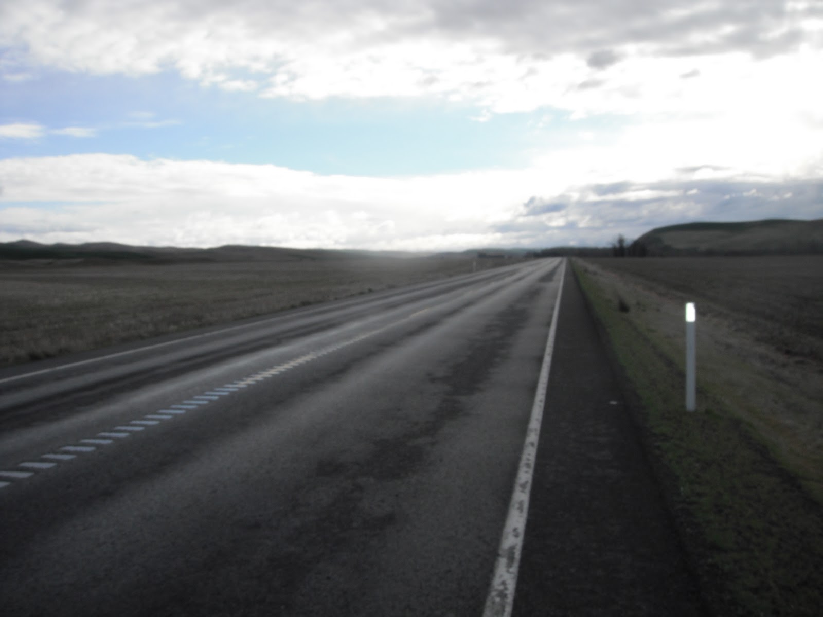
We were routed on a gently rolling road to avoid the busy Highway 12 as much as possible. It was quite pleasant. In short order, I was on to the main highway toward Randle. A car stopped on the opposite shoulder waved me down and asked about the ride. I was in the last half of the riders so she had undoubtedly seen a lot of us on the road. I gave her a very quick description of the ride and was joined by Larry from Pennsylvania with whom I rode for a bit. Just before Randle, I stopped to take a photo of Mt Adams and was alone again.

With the benefit of a strong tailwind, I arrived in Packwood quickly. I had a nice turkey sub, chocolate milk and topped off my water bottle for the climb of White Pass that loomed ahead. While waiting to get my sandwich, another customer asked me again about the ride and peculiar bikes that were in evidence. I rode out with Jeff Loomis and we stayed together until the 123 turnoff about 12 miles from the summit—the point where the climb begins in earnest with a mostly steady six percent grade for the duration. The last I saw of Jeff was when he turned in to the Palisades viewpoint ahead of me. I stopped there for a photo as well.

I plodded on up to the summit where the sweep vehicle was parked and made for a good, safe place to stop and put on some warm clothes for the descent. After all the climbing, it was fun to just let the bike run for seven miles. I was quickly at the Clear Lake control where we were well taken care of by the always helpful SIR volunteers. I had some cup of noodle (I call it one of the magic elixir of randonneuring). After the brief stop, I continued on alone with one other rider in the distance. Other than almost running over a freshly dead skunk just before Naches, the ride to the overnight was uneventful.

The showers were cold, but the welcome and food was warm. Terry had met some clients who live on a beautiful estate on the edge of Naches for dinner. I was treated to the delicious leftover mac and cheese and a piece of steak. I grabbed my bed roll and requested a 4:30 wake up. That would give me 4 hours of sleep before starting the second day. I was quite jealous of all the other faster riders already asleep all around me.

Day 2: Naches – Quincy

A large number of riders had requested a 4:00am wake up call. Therefore, I was awake at 4:00 as well, and by 4:15 decided it was stupid to lay awake on the gym floor. Time to get moving—the clock is always ticking on a brevet. Charlie White was in the kitchen making pancakes and breakfast sandwiches. I had some of each and a lot of coffee.

I started the climb to the Lodgepole control alone. The typical west wind was coming down the pass. I soon joined Don and Elaine Jameson and we began to work together against the wind. We caught Jeff Loomis, and he joined our little pace line. Rick Blacker and some other riders caught us and we formed a functional (if not pretty) rotating pace line that functioned well until the grade steepened a bit and the stronger riders were off the front. Jeff and I continued on and stopped at Cliffdell where I had another breakfast sandwich. We agreed to try and stay together and we continued on toward Lodgepole, still against the headwind.

Resting briefly at the Lodgepole control, I had some coffee and filled my water bottle at the campground pump. I rode over to the restroom without telling Jeff. By the time, I got done he had gone on without me thinking that I’d already left--my fault for not telling him I was only riding over to the restroom. I caught him just prior to Cliffdell on the way down.


When we got to Naches again, the route had us riding on the Old Naches Highway. It is a nice low traffic road with some small rollers. It was a nice change from Highway 410—the road with more ‘fingers’ per mile than any I’ve ever ridden. It didn’t matter if we were on the shoulder, single or riding in a group. Yakima County clearly does NOT like bicyclists.

We decided to stop a convenience store in Naches to get some ice cream. It was starting to get hot and the tailwind that had benefited the pre-riders the previous Saturday was not in evidence. While we were at the store, we were joined by Joe Platzner, Pat Leahy and James McKee. The group continued on to Fruitvale together. Jeff and I had decided earlier that we were hungry for burgers and to stop at McDonalds for the control. The other riders were agreeable so we all stopped for a quick lunch.

It was early afternoon and the heat was beginning to make itself felt. We all made sure our bottles were full. Pat stopped and bought an extra bottle just in case. The ride on the Yakima Greenway mostly parallels the river and was pleasant. We were soon headed east on Hwy 24 headed into the Rattlesnake Hills during the hottest part of the day.

The combination of heat, false flat and a slight headwind began to take its toll. First Pat and then James were off the front leaving just Joe, Jeff and I. Joe was struggling and I wasn’t doing much better. About 10 miles out, I was off the back and beginning to think about quitting. It was without question the low point of the ride for me. Another rider passed and asked how I was doing. My response was to whine about the heat. He would have none of it. I’m not quite sure how, but his attitude changed mine and I focused on what I could do instead of what I could NOT do. I drafted him to bridge back to Joe and Jeff and he was on his way. They told me the unknown rider was Ron Himschoot. He doesn’t know it yet, but he probably saved my ride.

When we got to the 241 intersection, we found some other riders stopped at a cafĂ© still under construction. The nice people working there were finishing up its rebuild after a fire. They generously let us take water from their pump and use the port-a-potty. Refreshed by this brief stop, we continued on the short climb and the fun, fast descent down to highway 243 and one of the gates to the Hanford Reservation where we turned left toward the Vernita Bridge. We stopped at the rest area to fill our bottles and rest for the climb that awaited us just after the bridge. Jeff’s mother had driven up from the Tri-Cities to see him and say ‘hello.’ She offered us some treats, but we politely refused on the grounds that taking outside support was against the rules.

I had been dreading the ‘Road L’ climb since I first saw it during the pre-ride support. It had been looming big in my mind all day, and my poor performance on White Pass the day before did not help. To my surprise, I made it up without much problem. Joe was just ahead of me and Jeff not too far behind. We continued on reaching Mattawa just at dusk and were treated to sandwiches made to order and other goodies. I had forgotten to refill my supply of chamois cream before leaving Naches (a mistake I wouldn’t make again). I bummed some off of Charlie. I noticed the sweep vehicle had arrived with a bike on the back. I recognized it as belonging to Irene, the rider from Colorado with whom I had ridden on Day 1. I was disappointed for her as I assumed this meant a DNF. Later, I would find out that she recovered and was taken back to the point where she’d been picked up and continued on to make the overnight control with time to spare.

When we got to George, we thought we were home free. There didn’t seem to be much of a headwind and only 10 miles to go. About 5 miles out, the headwind started up again slowing us down. We finally made it to Quincy just after two. The menu consisted of hearty chicken soup with rice. I had two bowls. Terry was so tired from staying up all night in Naches that he’d gotten a motel room. Lucky me! I would get only two hours of sleep, but it would be in a comfy bed instead of on the gym floor and I’d get a nice warm shower as well. I was asleep before my head even hit the pillow.

Day 3: Quincy – Mazama

I expected this to be a tough day. It would be hot and there would be some pretty significant climbs as well, the last being Loup Loup Pass followed by 30 miles to the overnight control in Mazama. After breakfast, I left Quincy alone. We were routed on a pleasant back road that took us through the agricultural richness of the fields surrounding Quincy. The diversity of crops grown in the area is really amazing. I continued on through Ephrata and Soap Lake stopping only briefly to call Terry and request that he bring me some antibiotic with ‘pain relief’ for my saddle sores and some batteries at either Dry Falls or Farmer.

Terry passed me while I was making the climb up to Dry Falls. I stopped to take a picture of Blue Lake and the Coulee below just before the top. When I got to Dry Falls, Terry had dropped off the requested supplies and gone in to Coulee City to buy some more pop because the control was running out. He got back just as I was getting ready to leave and snapped my picture as I rolled out.

James McKee had left the control not long before me and I could see him in the distance as I turned west on Highway 2. Another long, steady climb ensued with James becoming a smaller dot in the distance. The tandem team from California also passed me.

If it had not been for the bumps caused by the expansion joints, the descent into Moses Coulee would have been fun. Instead it was a bone shattering thunk-thunk at high speed. I feared it would damage my wheels. I was happy to reach the coulee floor even though it meant I would soon be making the climb out again.

After having struggled a bit during the first two days, I was surprised to find I felt good and the climbing seemed easier today. Arriving at the Farmer control, I was greeted by helpful SIR volunteers (Tom and Sue) and found plenty of food and supplies. It was a welcome oasis in the middle of literally nowhere. I made sure my bottles were full and took off toward Bridgeport alone.

Near the point where the highway turns back to the east, I was passed by the tandem team and Larry from PA. James, who had been riding just ahead, let me catch up and we rode together the rest of the afternoon until Mallott where he had to take the 1000K route. Just as we reached the turn for Bridgeport, we were passed by Wolfgang from Germany. We were soon greeted by a sign warning of an 8 mile downhill grade to the river. We were on our way—what fun! James and I stopped briefly at the Chief Joseph Dam Viewpoint and took pictures. We also stopped at the mini mart for ice cream and snacks, and visited with Wolfgang while we rested.
The main street in Bridgeport is lined with dead street trees that have been carved into an assortment of sculptures--making lemonade from lemons as they say. Here we found Wolfgang stopped on the side of the road. I assumed he was just checking out the trees, but he had just discovered his control card was missing. We suggested he go back and make sure he hadn’t dropped it at the store.

Wolfgang caught up with us at Brewster still without his card. He stopped for water while James and I continued on Old 97 to Mallott. Part of this road had just been repaved the week before and the new section was sweet and smooth. At the Mallott control, Mike McHale and Nicole were making sandwiches to order. There was also good news for Wolfgang. Another rider had found his card and it would be arriving at the control. Since James was doing the 1000K route, we parted company and I continued on toward Loup Loup Pass.

Shortly after turning on to Hwy 20 I decided to turn on my lights only to discover my dyno headlight isn't working. At first, I assume it is just a loose wire, but that was not the case. Unable to get it to work, I face the prospect of having to descend Loup Loup pass with my barely adequate backup light [Note-After the ride, I returned the B&M IQ Cyo to Peter White who promptly returned a new replacement under warranty]. It is a bit after 7:00pm. I decide to try and push myself to get to the top ASAP in hopes that there will still be ambient light for the descent. I make a good effort, but it is pitch dark by the time I reach the summit. In order to prevent outrunning my light, I coast to the limit; brake and then stop to make sure my rims don’t overheat. This goes on for about four miles. Finally, I see the lights of other riders descending the pass. I follow Don and Elaine down. After clearing the steep part of the descent, my backup lights are adequate for the remainder of the ride to Mazama. The miles click off slowly. I get to the point where I am wondering if my Garmin is broken.

After making it to the overnight, I have two bowls of chili and cookies and brownies. We all have real beds and nice hot showers for the third overnight. I had no problem falling asleep. My plan is to get up early enough to be on the road at least an hour before the control closes.

Day 4: Mazama – Monroe

I know I will give up time on the climb up Washington Pass. My plan is to have at least an hour in the bank when I leave Mazama as a cushion for the climb of the pass. I expect to easily make up time on the long descent from Rainy Pass to Marblemount.

The climb up Washington Pass goes as expected. I only stop twice for a brief rest. About a mile from the top, I stop and swap pictures with Joseph from San Francisco. When we make it to the summit, we trade photo ops again. The sweep vehicle is at the pull out just after the summit. I wave and continue on.

I quickly descend and then make the short run up to the Rainy Pass summit. It is now a long mostly downhill run to Marblemount. Terry takes my picture at the summit and I continue on alone. After a few miles, I see Jeff Loomis stopped in a pull out. He asks if I have any extra food and I give him a package of trail mix. Shortly after being passed by Irene from Colorado, Jeff and I start on down the pass.

We should have been making really good progress on the downhill, but there is a strong head/side wind that is negating a significant portion of our downhill advantage. Eventually we pass Robert and Chris who have stopped for a quick nap shortly after the Colonial Campground.

When we reach Newhalem, we stop to fill our bottles and a brief rest. Only 14 miles to the Marblemount control, but we haven’t made up any time. I’m starting to feel the effects of only eight and a half hours sleep in three days. I barely make it to Marblemount fighting sleep and fatigue the entire distance.

In order to fight of the effects of fatigue, I opt for a Red Bull along with a burrito and carrot cake at the Marblemount control. Chris and Robert arrive just after us. The clerk signs Chris’s card and then continues to examine it closely. He turns the pages back and forth and studies it carefully. He finally hands the card back to Chris with the remark – ‘You guys have been to a lot of places’ – he doesn’t know the half of it.

As we are getting ready to leave Marblemount, Chris Heg and James Mckee blast into the control. They are riding the post 1000K permanent and have made the control with just 5 minutes to spare.

Jeff and I are debating whether it will be better to push and attempt to get to Granite Falls before the McDonald’s closes or to take a meal stop in Darrington and just a quick stop in Granite Falls. We decide it will be better to stop in Darrington so we don’t risk missing an opportunity to get a good meal. This decision made, we head out with the end of the ride starting to be in sight.

During a brief stop to set our lights, we are passed by Irene who asks to join us. The strong lady from Colorado who almost DNF’d on day two is on track to finish the ride.

Irene, Jeff and I ride on together and opt for a little burger joint in Darrington It was a great choice. We all got burgers, fries, milkshakes and coffee. It was heaven. Just as our food arrives we are again joined by Chris and James. We all know we have plenty of time and should easily finish in the time limit. As we get ready to continue on to Granite Falls, we see Chris and Robert leaving a convenience store just up the road.

About a mile out of town we see Robert and Chris ahead. Chris is on the ground. Something is clearly wrong. When we get to them, we discover that Chris’s back has seized up on him; apparently the result of an accident he had on day one. He can barely move and it is clear that he cannot continue. We call for the sweep vehicle. It arrives quickly Dan Turner attends to Chris getting him safely in his truck. Our threesome becomes four as we are joined by a dejected Robert. Chris and Robert are fast friends and they have ridden together for three years. They had hoped to finish the Cascade together and Chris gave it his best, but it was not to be

Having an amicable foursome made the long stretch from Darrington to the turn to Arlington Heights road go much faster. It started to rain as we approached Arlington and we debated whether it was going to be significant or not. I decided to go ahead and gear up for rain.

Eventually, the rain actually became pretty heavy. Irene was beginning to bonk and felt cold. We rummaged through our gear and provided her with gloves, scarf and a cap. That helped her out a lot and we made it to Granite Falls in time to be the last customers at the Chevron. I had another Red Bull and a candy bar. The final stretch of the ride lay before us, and we were going to make it.

We skirted the east side of Lake Roesinger and were soon on Woods Creek Rd which had more rollers than I remembered. Less than three miles from the end, Irene started to bonk again. Robert alertly noticed her condition and we stopped so he could give her some energy gel and water. I tried to encourage her by stating there was less than three miles to the finish. Her response was an anguished ‘Three Miles!’ I changed my strategy and stated there was less than a half a mile to the next turn. This was more palatable.

After the brief stop, we continued on. We were quickly at the finish where we greeted by the enthusiastic cheers of the finish control volunteers and family. It was finally over and we had 1.5 hours to spare. Irene had turned a near DNF on day 2 to success. Robert overcame having to leave his good friend, Chris, behind. We were all elated to be done. What an adventure! What an accomplishment!